


Helipaddy: Heli Landing Sites
2.44.00 Reviews
App Specs
- Version
- 5.5.7
- Updated On
- License
- Free
- Downloads
- 10,000+
- Developer
- Helipaddy Ltd
- Categories
- Travel & Local
- Platform
- Android
Screenshots

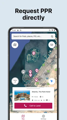
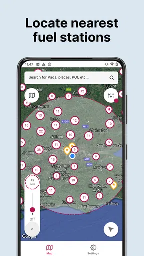
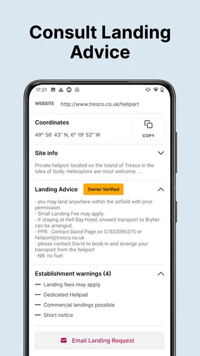
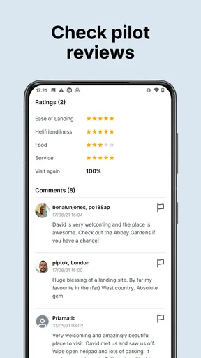
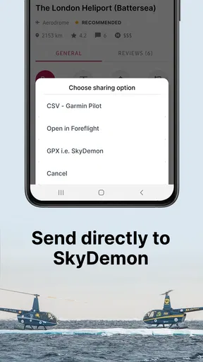
 Analysis by AppCompare
Finding a practical helicopter landing site is a very different task from finding a hotel, fuel station, or tourist attraction. That is where Helipaddy: Heli Landing Sites tries to earn its place: it is a travel and local app built around a specialist directory of helicopter landing pads rather than general road navigation. After spending time with it, my view is straightforward: it is most useful as a planning reference for pilots and helicopter passengers, but it should be treated as one source of information rather than the only basis for a flight decision.
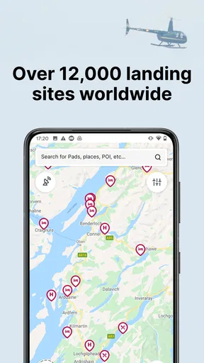
The app comes from Helipaddy Ltd and is free to install, which makes it easy to test before deciding whether it fits your routine. Its store summary points to a directory of more than twelve thousand landing sites, giving it a much narrower but more purposeful focus than ordinary map apps. The audience is also clear. If you occasionally need to identify possible landing locations, check what exists near a destination, or organize a helicopter trip around available pads, this is far more relevant than searching a normal map for a vague “helipad” label.
How Helipaddy works as a landing-site planning tool
I use Helipaddy as an early planning aid, not as a final answer about whether a landing site can be used. In this section, I focus on how its specialist directory can help narrow the search and shape better questions for the operator. The useful next step is to weigh that focused role against the broader tools travelers and pilots already rely on.
A specialist directory is the main advantage
The strongest part of the experience is the decision to make landing sites the center of the product. General mapping apps are excellent for roads, addresses, businesses, and broad geographic orientation, but helicopter landing information is often scattered across unrelated searches. A dedicated directory gives the task a more natural starting point: instead of asking whether a place appears on a map, I can begin by thinking about the destination, the surrounding area, and the landing options that may be relevant.
That difference matters when a trip is still at the planning stage. Imagine arranging a flight to a rural hotel, private property, event venue, or remote meeting location. A normal map may show the destination clearly while offering little useful guidance about helicopter access. Helipaddy is more purposeful in that situation because it encourages me to investigate the landing-site side of the journey before I commit to a route or assume that the final destination can receive an aircraft.
The directory scale is also meaningful. A collection described as exceeding twelve thousand sites can be useful for more than major airports and well-known commercial facilities. It suggests a broader search space that may include less obvious places, which is exactly where a niche app can outperform a familiar navigation tool. The practical benefit is not simply seeing a pin; it is discovering that a possible landing location exists near the place I actually need to reach.
Useful for planning, not a replacement for aviation judgement
I would use this app early in a trip workflow. First, I would look for landing sites near the destination. Next, I would compare those locations with the actual pickup point, road access, and the operator’s preferred arrangements. Only after that would I treat the result as a candidate for further checking. This order prevents a common mistake: confusing “listed in an app” with “available and suitable for this flight.”
Worth Reading Before You Choose

Flipboard Shows What News Apps Must Do Beyond the Feed

Switching to Android Auto Means Rethinking Your Driving Routine

Google Calendar Makes a Crowded Week Easier to Manage

Ludo King Makes the Most of the Minutes Between Plans

Baby Panda World Brings Quick Play to Modern Phones, but Its Game Library Feels Busy

ESPN’s Live Game View Makes Following Close Games Easier
That distinction is especially important with specialist directories. A landing site may be private, restricted, temporary, unsuitable for a particular aircraft, or dependent on permission. The app can help me find possibilities, but the final decision belongs with the pilot, operator, site owner, and applicable aviation requirements. In my experience, the best way to use it is as a discovery and cross-checking layer, not as an automatic clearance system.
For a passenger, this also makes the app more useful than it might first appear. I do not need to be the person flying the helicopter to benefit from knowing where the proposed landing point is. I can use the location to understand the last part of the journey, estimate whether a road transfer will be needed, and spot when a destination is not directly served by a nearby pad. That makes conversations with the operator more concrete.
A realistic everyday scenario
Consider a weekend trip to a countryside property. The booking information gives a destination name, but the property is not obviously connected to a recognized airport. Before departure, I would search the surrounding area in Helipaddy and note the closest plausible landing locations. If one appears near the property, I would still ask the operator whether it is authorized for the planned arrival, whether permission is required, and how the final transfer will work.
If the nearest listed site is several miles away, that is still valuable information. It changes the plan before the day of travel rather than after landing. I might arrange a car, choose a different arrival point, or decide that a conventional airport and road transfer are more sensible. The app’s value in this example is not that it makes the decision for me; it exposes a logistical issue early enough to solve it.
Three practical habits that improve the experience
My first tip is to search with the whole journey in mind rather than focusing only on the exact destination. A site just outside a town may be much more useful than a pin that looks closer but has awkward road access. Once I identify candidates, I would compare them with the actual address and ask how the passenger or equipment will move between the pad and the final stop.
My second tip is to record the context of every promising result while planning. A pin alone is not enough for a serious trip. I would note the site name, its relationship to the destination, and any follow-up questions for the operator. This avoids reopening the same search repeatedly and helps separate confirmed arrangements from possibilities discovered during browsing.
My third tip is to use the directory before the itinerary becomes fixed. If I search only after flights, accommodation, and transfers are booked, the app may reveal that the chosen destination is inconvenient from the air. Used earlier, it can influence the choice of arrival point and make the rest of the journey more coherent. That is a small workflow change, but it is one of the clearest ways to get value from a specialist location app.
Where it compares well with ordinary alternatives
Google Maps and similar services remain better for turn-by-turn driving, street-level orientation, businesses, and the final road connection. They are also more familiar to passengers who simply need to reach a known address. Helipaddy has a different job. Its advantage appears before the road journey, when the question is whether a helicopter landing option exists in the first place.
Airport directories can be stronger when the trip depends on established airports, runways, services, or scheduled aviation infrastructure. They are not necessarily designed around smaller landing locations close to private destinations. Helipaddy is more appealing when the destination is unusual and the important question is proximity to a pad rather than access to a conventional airport.
Aviation charts and official operational sources remain essential for professional flight decisions because they serve a different purpose. They are not interchangeable with a consumer-facing directory. I see Helipaddy as a convenient first pass that can make a later, more formal check faster and more targeted. If I already have authoritative operational information from a flight organization, that material should take priority.
The important weakness: a directory cannot guarantee usability
The main limitation is built into the concept. A landing-site directory can point me toward a location, but it cannot remove the real-world conditions that determine whether that location works today. Access, permission, aircraft requirements, local restrictions, weather, and operational judgement all remain outside the simple act of finding a site. That creates a risk of false confidence for anyone who treats a listing as a confirmed booking or approval.
This is also why the app may feel less satisfying to casual travelers. Someone looking for a complete journey planner may expect directions, transport connections, accommodation details, and a clear arrival workflow in one place. Helipaddy is narrower. Its focus is useful precisely because it avoids becoming a generic travel app, but that focus means I still need other tools for the rest of the trip.
The store rating is a modest 2.4 average from around fifty-seven ratings, with four written reviews shown alongside it. I would not use that figure alone to dismiss the app, because specialist tools often serve a smaller and more demanding audience than mainstream travel products. Still, it is a sensible reason to test the app personally before depending on it for an important journey. A tool can be conceptually valuable and still have rough edges that matter in daily use.
There is another practical consideration around cost. The app itself is free, while in-app purchases are listed at $59.99 per item. That makes the initial trial relatively easy, but anyone considering paid functionality should understand how it fits into their actual workflow before spending money. For occasional curiosity, the free entry point may be enough. For recurring professional or operational use, I would first confirm that the paid option delivers information or convenience I genuinely need.
What the version and device requirements mean
The current version is 5.5.7, and the app requires Android 6.0 or later. That makes compatibility broad enough for many older Android devices, although I would still check the phone before a trip rather than assuming every handset will behave identically. A travel tool is most useful when it has been opened, tested, and understood before leaving reliable connectivity and familiar surroundings.
I would also avoid making it the only copy of a planned route or landing-site shortlist. Saving important details elsewhere, taking appropriate notes, and keeping the operator’s instructions available are sensible precautions. This is not a criticism unique to Helipaddy; it is simply good practice whenever a trip depends on location information and timing.
Who will get the most from it?
The best audience is made up of helicopter pilots, operators, frequent helicopter passengers, property managers, event planners, and travelers visiting places where normal airport access is inconvenient. These users already understand that the final landing point can be as important as the destination itself. For them, a dedicated source of landing-site possibilities can save time during early planning and help reveal alternatives that a standard map search might overlook.
It may also suit people who coordinate several destinations. A property manager arranging arrivals for guests, for example, could use the directory to begin a regional shortlist before contacting the relevant parties. An event organizer could inspect the area around a venue and identify questions that need answering well before the event date. In both cases, the app is valuable as a planning prompt: it helps turn an assumed arrival plan into something that can be checked.
I would recommend skipping it if your travel is entirely conventional and you only need walking directions, driving navigation, public transport, or restaurant discovery. Google Maps or another mainstream travel app will be simpler for those needs. I would also skip relying on Helipaddy alone if you are unfamiliar with helicopter operations and expect the app to tell you whether a site is legally or operationally suitable. That is the point where professional advice and authoritative operational sources become more important than convenience.
How I would use it before committing to a flight
I would begin several days ahead, searching around the true destination rather than just the town name. I would create a short list of plausible sites, then ask the operator which one is acceptable for the aircraft and schedule. I would confirm whether the site is available, whether permission is needed, and what ground transfer is arranged. If the app shows several nearby options, I would treat that as a useful conversation starter rather than choosing the closest pin automatically.
For a passenger, the most important question is often not “Where is the pad?” but “What happens after landing?” A location that looks close on a map may still require a transfer, a gate arrangement, or coordination with someone on the ground. Helipaddy helps me ask those questions earlier. That is a more realistic benefit than expecting the app to provide a complete door-to-door itinerary.
My final verdict
Helipaddy: Heli Landing Sites is a focused tool with a clear reason to exist. Its large specialist directory gives helicopter-related planning a more useful starting point than a general map, especially when the destination is private, rural, unusual, or poorly served by conventional airports. I like it most as a way to discover candidate landing locations, compare the geography of a trip, and identify logistical questions before they become last-minute problems.
Its weakness is equally clear: finding a site is not the same as confirming that it can be used. The app cannot replace pilot judgement, operator coordination, permission checks, or authoritative operational information. The free price makes trying it straightforward, but the relatively low 2.4 average rating and the optional $59.99 in-app items give me reason to evaluate it against my own needs rather than assuming it will suit everyone.
My recommendation is specific: install it if helicopter landing-site research is a real part of your work or travel planning, and use it as the first layer of a careful workflow. If you only need ordinary navigation, it will probably feel too specialized. For the right user, though, that specialization is the point. It does not try to be every travel app; it concentrates on a difficult question that mainstream alternatives often handle poorly.
Pros
- Extensive database of helicopter landing sites worldwide
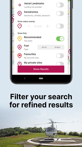
- Useful filters help pilots find suitable locations quickly
- Includes site details
- coordinates
- and operational notes
- Supports trip planning with multiple destinations
- Regularly updated by an active aviation community
Cons
- Coverage and accuracy can vary by country or remote region
- Some advanced features may require a paid subscription
- Not every listed site has recent condition information
- Requires reliable GPS and mobile data for best results
- Pilots must independently verify permissions and landing safety
FAQs for Helipaddy: Heli Landing Sites
What is Helipaddy: Heli Landing Sites used for?
Helipaddy: Heli Landing Sites is designed to help helicopter pilots find, organize, and use information about helicopter landing locations. The app can be useful when planning flights, checking potential landing sites, and keeping important location details available while traveling. It is primarily a planning and reference tool, not a replacement for official aviation charts, flight information services, or pilot judgment.
Does Helipaddy provide reliable and official landing-site information?
The app may contain useful landing-site data, including locations and notes, but pilots should not assume that every listing is current, approved, or suitable for a particular operation. Site conditions, permissions, obstacles, weather, and local restrictions can change. Before using any location, verify the information through official aviation sources, landowners, operators, and current regulations. Treat the app as an additional reference rather than the sole source for flight decisions.
Can I use Helipaddy without an internet connection?
Offline availability depends on the specific features and data downloaded before leaving coverage. Some information may require an internet connection to load, update, or display correctly, while previously saved content may remain accessible. Pilots should test the app in advance and avoid relying on mobile data during flight. It is also wise to carry approved offline charts, navigation equipment, and backup documentation in case connectivity or battery power is unavailable.
Is Helipaddy suitable for professional helicopter pilots and private users?
Helipaddy can be useful for both professional and private helicopter users who need a convenient way to research landing sites and organize flight information. However, its usefulness depends on the coverage and quality of listings in the area where you fly. Professional operations should combine the app with company procedures, official aeronautical information, risk assessments, and required permissions. Recreational pilots should also confirm access, safety, and legal requirements before landing.
Does Helipaddy replace navigation apps, aviation charts, or pre-flight planning?
No. Helipaddy should be considered a supplementary planning tool rather than a complete navigation or flight-management solution. It does not remove the need to review current charts, weather, NOTAMs, airspace restrictions, fuel requirements, terrain, obstacles, and landing permissions. Pilots remain responsible for confirming that a site is appropriate and lawful. Always follow applicable aviation regulations and use certified equipment and official information for operational decisions.


